Why this loop matters
I love Famara for its raw coastline and wind-sculpted sand, and I’m equally drawn to the strange, quiet beauty around Los Jameos. This hidden loop between Caleta de Famara and Los Jameos is one of my favourite day hikes when I want a mix of dramatic coastal views, volcanic geology and a few quiet inland trails where you can catch your breath and refill water bottles. It’s not a well-marked “official” route on most tourist maps, which is exactly why I keep coming back — fewer crowds, better light for photos, and real opportunities to notice details few people see.
Overview: distance, duration and difficulty
The loop I describe here is approximately 18–22 km depending on small detours you choose. Expect 5–7 hours walking at a relaxed pace with photo stops. Difficulty is moderate: there are some rocky stretches, loose volcanic scree and a couple of short climbs. Good footwear, sun protection and at least 2–3 litres of water per person are essential.
Route summary (what to expect)
Start in Caleta de Famara, follow the coastal track north along the cliffs and beaches, then pick up a quieter inland trail that traverses lava fields and low ridges. You’ll cross some unpaved farm tracks, pass a few small villages where you can buy a drink, and rejoin the coast near the Los Jameos area. From there, you can detour to Los Jameos del Agua or the nearby natural pools and cafes before taking a return path that loops you back toward Famara through gentle valleys.
Detailed route with photography spots
Below I walk you through the hike as I usually do, with the spots I stop at for photos and why.
Caleta de Famara — first light and foreground interest
Begin early at the beach. The best light is before mid-morning when the cliffs cast long shadows and the tide often leaves wet sand that mirrors the sky. I like a wide-angle lens (I use a Sony RX100 for convenience) to capture the stretch of sand framed by Famara’s cliffs. Look for lone walkers, windsurfers and the curves of the shore for leading lines.
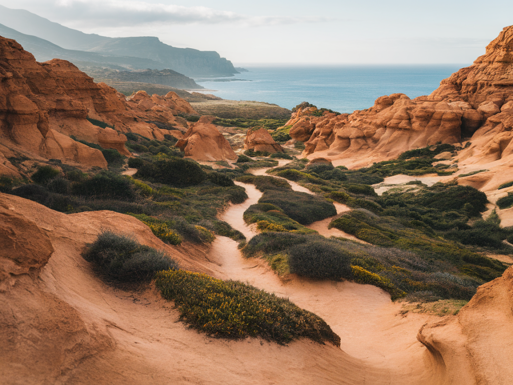
Cliff path north — texture and layers
The coastal track clings to rocky outcrops. Stop at points where the volcanic layers are exposed: the contrast between dark lava, pale ash, and blue Atlantic can be striking. A telephoto lens helps pull distant surfers or seabirds into the frame while compressing the layered cliffs.
Hidden cove detours — foreground rocks
If you descend to a small cove, use foreground rocks and pools for composition. Low sun creates tiny reflections and saturated colours. These spots are often empty — perfect for minimal seascapes.
Lava fields inland — abstract details
The inland trail crosses black, pitted lava. I switch to a macro-capable lens to capture textures: bubbles in solidified lava, lichen on rocks, and the occasional stubborn plant taking root. These are great for series or landscape detail shots.
Small village stop — human element
Halfway through the loop you’ll likely pass a small village or two (I often cut through parts of the Haría area). These villages are excellent for environmental portraits: a weathered doorway, pots of geraniums, a local café terrace. If you want to photograph people, ask first — it’s simple courtesy and usually rewarded with a smile or a short conversation.
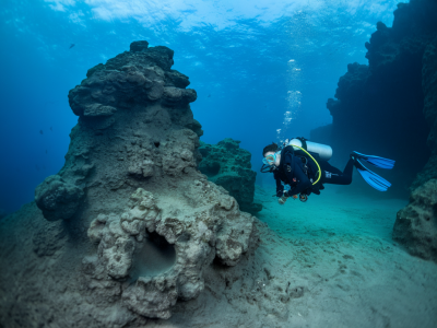
Los Jameos area — caves, pools and soft light
Approaching Los Jameos, the landscape changes again. The pools and caves here offer dramatic shadow-play. If you’re visiting Los Jameos del Agua itself there’s usually a small entrance fee, toilets and a café — handy for a longer break. Late afternoon is beautiful when soft light filters through rock openings.
Water refills and logistics
One of the reasons I prefer this loop to longer, exposed coastal treks is the mix of natural and small-village services.
If you prefer filtered water, a lightweight filter (Sawyer Mini or Katadyn BeFree) works well for topping up from taps in villages or trusted outdoor spigots.
Packing list (my essentials)
- Good trail shoes with grippy soles (La Sportiva or Salomon are my go-tos).
- 2–3 litres water, plus a light filter or purification tablets if you plan extra refills.
- Sun protection: hat, sunglasses, SPF 50, and a breathable long-sleeve layer.
- Light wind jacket — Lanzarote winds can pick up quickly.
- Phone with offline map (Maps.me or Gaia) and a paper map if you like backups.
- Camera gear: small tripod, wide-angle and a mid-tele lens; spare batteries and waterproof bag.
- Snack and lunch: energy bars, sandwiches, and some salty snacks for electrolytes.
- Basic first-aid, blister kit, and a whistle.
Safety notes and tide awareness
Parts of the coastal track are exposed and can be slippery after rain or heavy surf. I always check the day’s wind and swell forecast before heading out (Windy and Magicseaweed are my go-to apps). Avoid low coastal scrambles at high tide. If you plan to explore coves, be mindful of incoming waves — the Atlantic can change quickly.
Cell reception is generally okay on most of the route, but intermittent in some lava-field sections. Tell someone your plan and estimated return time if you’re hiking alone.
When to go
Early spring and autumn are my favourite seasons: cooler temperatures, steady light and good winds for dramatic skies without the peak-season crowds. Winter mornings can be exceptional for photography but bring more unpredictable weather. Summer can be very hot and exposed, so start very early and carry extra water.
Variations and extensions
If you want a shorter option, do a one-way walk from Caleta de Famara to Los Jameos and catch a taxi back. For a longer adventure, continue eastwards along the coast toward the Órzola/Peñas del Chache area, but remember logistics for water and transport become more challenging.
If you’d like, I can put together a downloadable GPX route, annotated photo stops and a printable packing checklist for this loop — just ask and tell me whether you prefer a shorter or longer version.